
We aimed to leave Hungary at a quiet border crossing in the north which we anticipated would be police and checkpoint-free.
We were still apprehensive of being tracked down and fined for our lack of documentation when quizzed by the Budapest police to whom we had given false details.
Our route out was through farmland and green hills dotted with small villages and old industrial centres alongside riverbanks. The high unemployment was obvious in the large numbers of people of all ages just hanging about.
The houses and apartment blocks were tatty, and our overall impression was of a sort of ‘beige’ living – houses and shop facades and old rusting cars all seemed to be in the same worn-out shades of brown and mustard yellows.
We stopped for a coffee just before noon at Banreve in a bar which had been serving alcohol since 7am that morning and opposite a bus stop where a line of young girls sat with their babies.

The strong coffee helped to overcome our nerves and we drove fast along the lonely and dusty road to the border with Abovce on the Slovakian side.
Our hopes of a discreet crossing were dashed at the sight of a checkpoint building painted in rusting orange and beige straddling the road and manned by a group of burly men in camouflage gear.
They were lounging against motorbikes and eating bread rolls. Seeing the makeshift picnic, we both realised that they were not border guards but travellers like us. It was with comic relief on our part and interest on theirs that we waved cheerily as we passed them and crossed into Slovakia.

With Bertha purring we headed east toward the High Tatras, Europe’s highest range of mountains and the western-most end of the Carpathians.
Our first impressions of Slovakia were of a continuation of Hungary. The same sort of beige-coloured rural villages and potholed roads continued as we began our climb up through the foothills of the Carpathians.

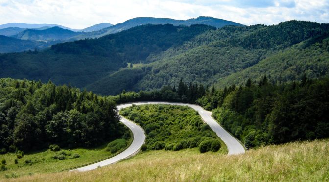
It was a tiring drive spinning up and round hairpin bends on rough roads and we stopped gratefully at a roadside shelter in Dobsina for views of the countryside far below. We were on the outskirts of the Slovensky Raj National Park.
Slovakia’s landmass is 90% above 400m and Bertha worked hard with pressure coming behind from increasing numbers of lorries and trucks driven fast and aggressively toward the industrial town of Poprad. We attracted curious looks from the drivers of the oncoming traffic.

Skirting the town on the ring road and heading towards the mountainous horizon we saw something new – the wide-scale use of acres of solar panels planted in fields alongside the roads, harvesting the sun for its power.
It was late afternoon when we both gasped at our first sight of the nearing High Tatras, seemingly dropped out of the sky onto the road and barring the way before us. This enormous mountain range of jagged peaks reaches 2,600km high and is only 25kms wide, so it really seems as though they have sprung up and out of the earth.

We found a local road through to our planned camp at Tatranska Lomnica, a winter ski resort. In 2011 most visitors to the area came from the Ukraine, Russia and the Baltic states during the New Year’s holiday. During the rest of the winter season, visitors were mainly from Poland, the Czech Republic, Hungary, and Slovakia. We were travelling in the quiet summer season of bikers and hikers and heading to a popular ‘sport camp’. Upon our arrival it was in a ruined state of demolition but eerily still had the welcome sign on its gates.
We passed quickly on and found a motel where we could camp in the adjacent field giving Bertha a splendid view of our next day’s challenge – to go up onto the mountains on foot and by cable car.
